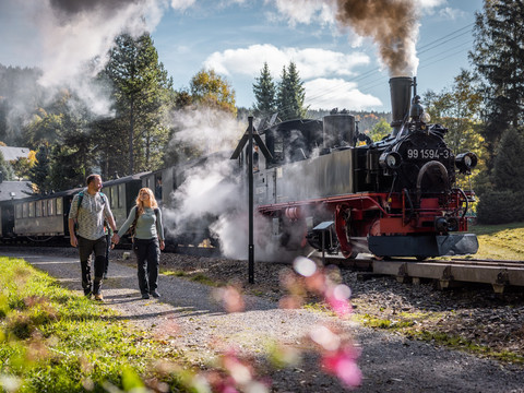
"S' kimmt wies kimmt!" It comes as it comes - or as we plan it. You should definitely plan the Kammweg so that you are on your way from Satzung to Bärenstein at the weekend. Because the Pressnitztalbahn then takes us from Schmalzgrube to Jöhstadt at full steam. It's a great experience on the train, but of course also on foot, when the steam locomotive puffs past you through the valley.
Passing the refuge "Lustiger Hans", we enter the forest on the post road, then march steeply downhill to Schmalzgrube. Schmalzgrube station is the operating centre of the Pressnitztalbahn. The museum railway with its steam locomotives and historic narrow-gauge wagons is today the driving force behind tourism in the Pressnitz Valley. It takes less than 20 minutes to get from here to Jöhstadt by train. It takes at least twice as long to walk along the Blackwater. Passing the Loreley Rock and Schlössel, we reach Jöhstadt railway station. Uphill, always along the edge of the forest, we stroll along with a fantastic panoramic view. Along the way we keep finding border stones with the letters D for Germany and C for Česká republika. At the top of the Old Salt Road we can already see the Bärenstein in the distance. Passing the Gypsy Rock, we reach the Brettmühle inn. Here you should definitely take a break. We continue along the cool Pöhlbach stream to the Fichtenhäusel adventure inn with soft ice cream. The Bärenstein is getting closer. Once again we have to take the "Berggang" and then we are at the top of the legendary Bärenstein.
Milestones: Hirtstein (890 m) with mountain inn - Schmalzgrube - Pressnitztalbahn - Schwarzwassertal - Jöhstadt - Grenzweg - Brettmühle with inn - Pöhlagrund with adventure hotel - Kühberg - Berg Bärenstein (898 m) with mountain hotel.

