© Yvonne Brückner, Tourismusverband Sächsische Schweiz

Großer Zschirnstein

W skrócie

  • Start: Car park Krippen
  • Cel: Car park Krippen
  • średnia
  • 17,73 km
  • 5 h 30 min
  • 571 m
  • 545 m
  • 125 m

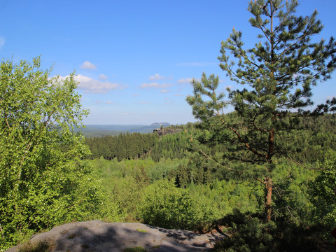
This hike offers impressive views and leads to the Großer Zschirnstein.

The highest elevation in Saxon Switzerland is the Großer Zschirnstein, a slightly sloping table mountain with excellent distant views. At its southern end is the "Mittagsstein", which at 562 m is the highest point of the massif. Here you can enjoy an impressive view.

Plan trasy

Nawierzchnia trasy

  • Nieznane (1%)
  • Ulica (4%)
  • Asfalt (18%)
  • Żwir (17%)
  • Szlak wędrowny (43%)
  • Ścieżka (19%)

Pogoda

Najważniejsze informacje

Dalsze kroki